
Description
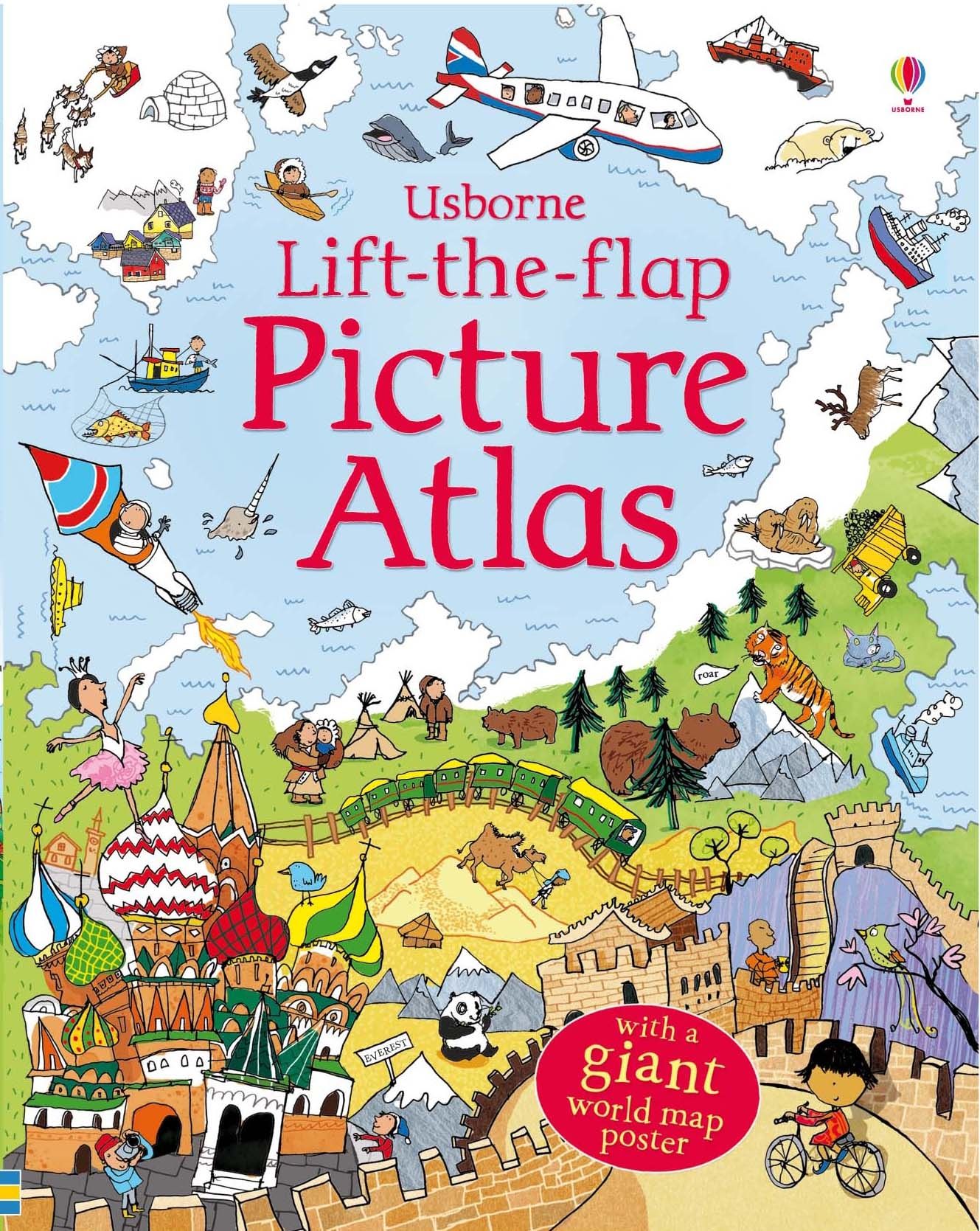
Lift-the-Flap Picture Atlas
-
This interactive board book is recommended for children aged 6 years and up, making it ideal for early primary school readers discovering geography.
-
The book is organized by continent (North America, South America, Europe, Africa, Asia, Oceania, Antarctica/Arctic), helping children explore the world in manageable sections.
-
Each double-page spread is packed full of facts about famous landmarks, exotic animals, diverse cultures, country borders and capital cities.
-
Featuring over 100 lift-the-flaps, children can engage physically with the book by lifting small flaps to reveal hidden information and details.
-
Includes a giant world-map poster, allowing children to display the world in one glimpse and reinforce what they’ve learned.
-
With vivid full-colour illustrations by Kate Leake and text by Alex Frith, the book supports visual learning, vocabulary expansion, map-skills and global awareness 🌍.
-
What’s in the box: 1 board-book atlas (16 pages) with lift-the-flaps and a world-map poster.
Dear parent or caregiver, this Lift-the-Flap Picture Atlas invites children on an exciting journey around the planet—encouraging curiosity, building knowledge of the world and supporting confidence as they uncover new places, people and environments together. It’s a wonderful resource to spark conversation, discovery and a lifelong love of learning. 😊
As Seen on The Late Late Toy Show


- Opens in a new window.


